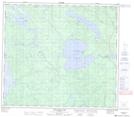
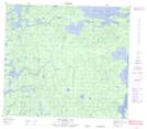
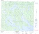
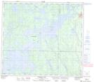
Maps showing Mistuhe Island, 83,84-19,20-W, Manitoba
Mistuhe Island is a Island located in 83,84-19,20-W, Manitoba and has an elevation of 281 meters.
- Latitude: 56° 14' 59'' North (decimal: 56.2496999)
- Longitude: 100° 30' 0'' West (decimal: -100.5000000)
- Topography Feature Category: Island
- Geographical Feature: Island
- Canadian Province/Territory: Manitoba
- Elevation: 281 meters
- Location: 83,84-19,20-W
- Atlas of Canada Locator Map: Mistuhe Island
- GPS Coordinate Locator Map: Mistuhe Island Lat/Long
Mistuhe Island NTS Map Sheets