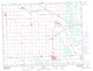
Maps showing Mitchell, 6-7-6-E, Manitoba
Mitchell is a Unincorporated area located in 6-7-6-E, Manitoba and has an elevation of 262 meters.
- Latitude: 49° 32' 3'' North (decimal: 49.5342000)
- Longitude: 96° 45' 43'' West (decimal: -96.7619000)
- Topography Feature Category: Unincorporated area
- Geographical Feature: Local Urban District
- Canadian Province/Territory: Manitoba
- Elevation: 262 meters
- Location: 6-7-6-E
- Atlas of Canada Locator Map: Mitchell
- GPS Coordinate Locator Map: Mitchell Lat/Long