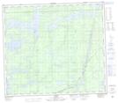
Maps showing Molly Creek, 79-4-E, Manitoba
Molly Creek is a River located in 79-4-E, Manitoba and has an elevation of 183 meters.
- Latitude: 55° 48' 42'' North (decimal: 55.8117000)
- Longitude: 96° 53' 37'' West (decimal: -96.8935999)
- Topography Feature Category: River
- Geographical Feature: Creek
- Canadian Province/Territory: Manitoba
- Elevation: 183 meters
- Location: 79-4-E
- Atlas of Canada Locator Map: Molly Creek
- GPS Coordinate Locator Map: Molly Creek Lat/Long