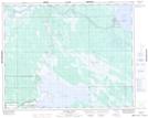
Maps showing Dauphin River, 26,35-34-5-W1, Manitoba
Dauphin River is a Unincorporated area located in 26,35-34-5-W1, Manitoba and has an elevation of 219 meters.
- Latitude: 51° 57' 35'' North (decimal: 51.9596999)
- Longitude: 98° 3' 55'' West (decimal: -98.0652999)
- Topography Feature Category: Unincorporated area
- Geographical Feature: Northern Community
- Canadian Province/Territory: Manitoba
- Elevation: 219 meters
- Location: 26,35-34-5-W1
- Atlas of Canada Locator Map: Dauphin River
- GPS Coordinate Locator Map: Dauphin River Lat/Long
Dauphin River NTS Map Sheets