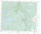
Maps showing Moose Meadows, 42,43-25-W, Manitoba
Moose Meadows is a Low vegetation located in 42,43-25-W, Manitoba and has an elevation of 290 meters.
- Latitude: 52° 41' 35'' North (decimal: 52.6931000)
- Longitude: 101° 1' 49'' West (decimal: -101.0303000)
- Topography Feature Category: Low vegetation
- Geographical Feature: Meadows
- Canadian Province/Territory: Manitoba
- Elevation: 290 meters
- Location: 42,43-25-W
- Atlas of Canada Locator Map: Moose Meadows
- GPS Coordinate Locator Map: Moose Meadows Lat/Long
Moose Meadows NTS Map Sheets