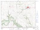
Maps showing Mowbray Plateau, 1-8-W, Manitoba
Mowbray Plateau is a Plain located in 1-8-W, Manitoba and has an elevation of 405 meters.
- Latitude: 49° 2' 20'' North (decimal: 49.0388999)
- Longitude: 98° 26' 5'' West (decimal: -98.4347000)
- Topography Feature Category: Plain
- Geographical Feature: Plateau
- Canadian Province/Territory: Manitoba
- Elevation: 405 meters
- Location: 1-8-W
- Atlas of Canada Locator Map: Mowbray Plateau
- GPS Coordinate Locator Map: Mowbray Plateau Lat/Long