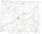
Maps showing Mullin Creek, 12-38-27-W, Manitoba
Mullin Creek is a River located in 12-38-27-W, Manitoba.
- Latitude: 52° 15' 17'' North (decimal: 52.2547000)
- Longitude: 101° 12' 3'' West (decimal: -101.2008000)
- Topography Feature Category: River
- Geographical Feature: Creek
- Canadian Province/Territory: Manitoba
- Location: 12-38-27-W
- Atlas of Canada Locator Map: Mullin Creek
- GPS Coordinate Locator Map: Mullin Creek Lat/Long
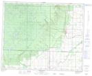
Mullin Creek NTS Map Sheets