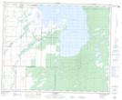
Maps showing Munro Slough, 27,28,35-39-24-W, Manitoba
Munro Slough is a Low vegetation located in 27,28,35-39-24-W, Manitoba.
- Latitude: 52° 23' 25'' North (decimal: 52.3902999)
- Longitude: 100° 49' 22'' West (decimal: -100.8227999)
- Topography Feature Category: Low vegetation
- Geographical Feature: Slough
- Canadian Province/Territory: Manitoba
- Location: 27,28,35-39-24-W
- Atlas of Canada Locator Map: Munro Slough
- GPS Coordinate Locator Map: Munro Slough Lat/Long