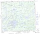
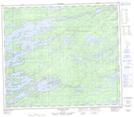
Maps showing Mutcheson Lake, 71,72-3,4-E, Manitoba
Mutcheson Lake is a Lake located in 71,72-3,4-E, Manitoba and has an elevation of 213 meters.
- Latitude: 55° 12' 5'' North (decimal: 55.2014000)
- Longitude: 96° 58' 6'' West (decimal: -96.9682999)
- Topography Feature Category: Lake
- Geographical Feature: Lake
- Canadian Province/Territory: Manitoba
- Elevation: 213 meters
- Location: 71,72-3,4-E
- Atlas of Canada Locator Map: Mutcheson Lake
- GPS Coordinate Locator Map: Mutcheson Lake Lat/Long
Mutcheson Lake NTS Map Sheets