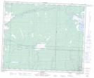
Maps showing National Mills, 27-44-29-W, Manitoba
National Mills is a Unincorporated area located in 27-44-29-W, Manitoba and has an elevation of 314 meters.
- Latitude: 52° 49' 45'' North (decimal: 52.8292000)
- Longitude: 101° 34' 49'' West (decimal: -101.5802999)
- Topography Feature Category: Unincorporated area
- Geographical Feature: Northern Community
- Canadian Province/Territory: Manitoba
- Elevation: 314 meters
- Location: 27-44-29-W
- Atlas of Canada Locator Map: National Mills
- GPS Coordinate Locator Map: National Mills Lat/Long