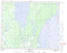
Maps showing Nealeys Point, 39,40-19-W, Manitoba
Nealeys Point is a Cape located in 39,40-19-W, Manitoba.
- Latitude: 52° 24' 30'' North (decimal: 52.4082999)
- Longitude: 100° 4' 26'' West (decimal: -100.0739000)
- Topography Feature Category: Cape
- Geographical Feature: Point
- Canadian Province/Territory: Manitoba
- Location: 39,40-19-W
- Atlas of Canada Locator Map: Nealeys Point
- GPS Coordinate Locator Map: Nealeys Point Lat/Long
Nealeys Point NTS Map Sheets