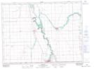
Maps showing Neubergthal, 25,26,35,36-1-1-W1, Manitoba
Neubergthal is a Unincorporated area located in 25,26,35,36-1-1-W1, Manitoba and has an elevation of 247 meters.
- Latitude: 49° 4' 29'' North (decimal: 49.0746999)
- Longitude: 97° 28' 52'' West (decimal: -97.4810999)
- Topography Feature Category: Unincorporated area
- Geographical Feature: Community
- Canadian Province/Territory: Manitoba
- Elevation: 247 meters
- Location: 25,26,35,36-1-1-W1
- Atlas of Canada Locator Map: Neubergthal
- GPS Coordinate Locator Map: Neubergthal Lat/Long