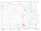
Maps showing New Bothwell, 19,29,30-7-5-E, Manitoba
New Bothwell is a Unincorporated area located in 19,29,30-7-5-E, Manitoba and has an elevation of 242 meters.
- Latitude: 49° 35' 26'' North (decimal: 49.5905999)
- Longitude: 96° 53' 25'' West (decimal: -96.8902999)
- Topography Feature Category: Unincorporated area
- Geographical Feature: Community
- Canadian Province/Territory: Manitoba
- Elevation: 242 meters
- Location: 19,29,30-7-5-E
- Atlas of Canada Locator Map: New Bothwell
- GPS Coordinate Locator Map: New Bothwell Lat/Long