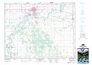
Maps showing Newton Siding, 15-11-5-W, Manitoba
Newton Siding is a Unincorporated area located in 15-11-5-W, Manitoba.
- Latitude: 49° 55' 37'' North (decimal: 49.9269000)
- Longitude: 98° 4' 39'' West (decimal: -98.0775000)
- Topography Feature Category: Unincorporated area
- Geographical Feature: Post Office
- Canadian Province/Territory: Manitoba
- Location: 15-11-5-W
- GPS Coordinate Locator Map: Newton Siding Lat/Long
Newton Siding NTS Map Sheets