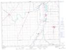
Maps showing Niverville, 30-7-4E, Manitoba
Niverville is a Town located in 30-7-4E, Manitoba and has an elevation of 236 meters.
- Latitude: 49° 36' 20'' North (decimal: 49.6056000)
- Longitude: 97° 2' 30'' West (decimal: -97.0416999)
- Topography Feature Category: Town
- Geographical Feature: Town
- Canadian Province/Territory: Manitoba
- Elevation: 236 meters
- Location: 30-7-4E
- Atlas of Canada Locator Map: Niverville
- GPS Coordinate Locator Map: Niverville Lat/Long
Niverville NTS Map Sheets