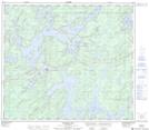
Maps showing Notigi Control Structure, 79-13-W, Manitoba
Notigi Control Structure is a Hydraulic construction located in 79-13-W, Manitoba and has an elevation of 267 meters.
- Latitude: 55° 51' 37'' North (decimal: 55.8603000)
- Longitude: 99° 19' 56'' West (decimal: -99.3322000)
- Topography Feature Category: Hydraulic construction
- Geographical Feature: Control Structure
- Canadian Province/Territory: Manitoba
- Elevation: 267 meters
- Location: 79-13-W
- Atlas of Canada Locator Map: Notigi Control Structure
- GPS Coordinate Locator Map: Notigi Control Structure Lat/Long
Notigi Control Structure NTS Map Sheets