Canada Topographic Maps

Numaykoos River Topo Maps

Topography maps and Latitude/Longitude Location

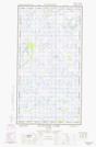
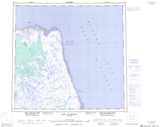
Maps showing Numaykoos River, Manitoba

Numaykoos River is a River located in Manitoba.

  • Latitude: 58° 12' 2'' North   (decimal: 58.2006000)
  • Longitude: 92° 55' 6'' West   (decimal: -92.9182999)
  • Topography Feature Category: River
  • Geographical Feature: River
  • Canadian Province/Territory: Manitoba
  • Atlas of Canada Locator Map: Numaykoos River
  • GPS Coordinate Locator Map: Numaykoos River Lat/Long

Numaykoos River NTS Map Sheets

054K02W Broad River Topographic Map at 1:50,000 scale

054K03E Kelsey Creek Topographic Map at 1:50,000 scale

054K03W Kelsey Creek Topographic Map at 1:50,000 scale

054K04E Fletcher Lake Topographic Map at 1:50,000 scale

054K04W Fletcher Lake Topographic Map at 1:50,000 scale

054K Cape Churchill Topographic Map at 1:250,000 scale

 
Buy Topographic Maps DVD
Newsletter Sign-up

Yes, I want to receive map store discounts.


Bookmark and Share