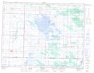
Maps showing Oak Lake Marsh, 27,34-8-25-W, Manitoba
Oak Lake Marsh is a Low vegetation located in 27,34-8-25-W, Manitoba and has an elevation of 416 meters.
- Latitude: 49° 41' 28'' North (decimal: 49.6911000)
- Longitude: 100° 47' 21'' West (decimal: -100.7891999)
- Topography Feature Category: Low vegetation
- Geographical Feature: Marsh
- Canadian Province/Territory: Manitoba
- Elevation: 416 meters
- Location: 27,34-8-25-W
- Atlas of Canada Locator Map: Oak Lake Marsh
- GPS Coordinate Locator Map: Oak Lake Marsh Lat/Long