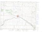
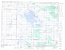
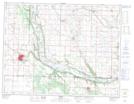
Maps showing Oak Lake Sand Hills, Manitoba
Oak Lake Sand Hills is a Mountain located in Manitoba and has an elevation of 423 meters.
- Latitude: 49° 42' 13'' North (decimal: 49.7036000)
- Longitude: 100° 35' 50'' West (decimal: -100.5972000)
- Topography Feature Category: Mountain
- Geographical Feature: Sand Hills
- Canadian Province/Territory: Manitoba
- Elevation: 423 meters
- Atlas of Canada Locator Map: Oak Lake Sand Hills
- GPS Coordinate Locator Map: Oak Lake Sand Hills Lat/Long
Oak Lake Sand Hills NTS Map Sheets