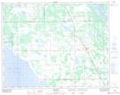
Maps showing Oatfield, 34-22-7-W, Manitoba
Oatfield is a Unincorporated area located in 34-22-7-W, Manitoba.
- Latitude: 50° 57' North (decimal: 50.9500000)
- Longitude: 98° 21' West (decimal: -98.3500000)
- Topography Feature Category: Unincorporated area
- Geographical Feature: Post Office
- Canadian Province/Territory: Manitoba
- Location: 34-22-7-W
- GPS Coordinate Locator Map: Oatfield Lat/Long