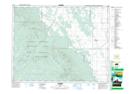
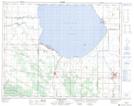
Maps showing Ochre River, 24-17-W, Manitoba
Ochre River is a River located in 24-17-W, Manitoba and has an elevation of 612 meters.
- Latitude: 51° 6' 38'' North (decimal: 51.1105999)
- Longitude: 99° 44' 41'' West (decimal: -99.7446999)
- Topography Feature Category: River
- Geographical Feature: River
- Canadian Province/Territory: Manitoba
- Elevation: 612 meters
- Location: 24-17-W
- Atlas of Canada Locator Map: Ochre River
- GPS Coordinate Locator Map: Ochre River Lat/Long
Ochre River NTS Map Sheets