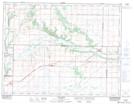
Maps showing Old Baldy, 9-11-21-W, Manitoba
Old Baldy is a Mountain located in 9-11-21-W, Manitoba and has an elevation of 386 meters.
- Latitude: 49° 54' 56'' North (decimal: 49.9156000)
- Longitude: 100° 17' 20'' West (decimal: -100.2888999)
- Topography Feature Category: Mountain
- Geographical Feature: Hill
- Canadian Province/Territory: Manitoba
- Elevation: 386 meters
- Location: 9-11-21-W
- Atlas of Canada Locator Map: Old Baldy
- GPS Coordinate Locator Map: Old Baldy Lat/Long