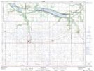
Maps showing Old Mill Creek, 17-3-13-W, Manitoba
Old Mill Creek is a River located in 17-3-13-W, Manitoba.
- Latitude: 49° 13' 8'' North (decimal: 49.2189000)
- Longitude: 99° 11' 12'' West (decimal: -99.1866999)
- Topography Feature Category: River
- Geographical Feature: Creek
- Canadian Province/Territory: Manitoba
- Location: 17-3-13-W
- Atlas of Canada Locator Map: Old Mill Creek
- GPS Coordinate Locator Map: Old Mill Creek Lat/Long