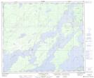
Maps showing Ominawin Rapids, 63-4-W, Manitoba
Ominawin Rapids is a Rapids located in 63-4-W, Manitoba.
- Latitude: 54° 26' 46'' North (decimal: 54.4461000)
- Longitude: 98° 3' 20'' West (decimal: -98.0556000)
- Topography Feature Category: Rapids
- Geographical Feature: Rapids
- Canadian Province/Territory: Manitoba
- Location: 63-4-W
- GPS Coordinate Locator Map: Ominawin Rapids Lat/Long
Ominawin Rapids NTS Map Sheets