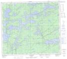
Maps showing Onikup Lake, 77,78-2-E, Manitoba
Onikup Lake is a Lake located in 77,78-2-E, Manitoba and has an elevation of 183 meters.
- Latitude: 55° 43' 20'' North (decimal: 55.7221999)
- Longitude: 97° 14' 10'' West (decimal: -97.2361000)
- Topography Feature Category: Lake
- Geographical Feature: Lake
- Canadian Province/Territory: Manitoba
- Elevation: 183 meters
- Location: 77,78-2-E
- Atlas of Canada Locator Map: Onikup Lake
- GPS Coordinate Locator Map: Onikup Lake Lat/Long
Onikup Lake NTS Map Sheets