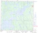
Maps showing Osakeeweepatheehowin Point, 25-84-20-W, Manitoba
Osakeeweepatheehowin Point is a Cape located in 25-84-20-W, Manitoba and has an elevation of 268 meters.
- Latitude: 56° 18' 24'' North (decimal: 56.3066999)
- Longitude: 100° 28' 0'' West (decimal: -100.4666999)
- Topography Feature Category: Cape
- Geographical Feature: Point
- Canadian Province/Territory: Manitoba
- Elevation: 268 meters
- Location: 25-84-20-W
- Atlas of Canada Locator Map: Osakeeweepatheehowin Point
- GPS Coordinate Locator Map: Osakeeweepatheehowin Point Lat/Long
Osakeeweepatheehowin Point NTS Map Sheets