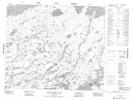
Maps showing Oseekan Rapids, Manitoba
Oseekan Rapids is a Rapids located in Manitoba and has an elevation of 240 meters.
- Latitude: 54° 1' 49'' North (decimal: 54.0302999)
- Longitude: 94° 47' 25'' West (decimal: -94.7902999)
- Topography Feature Category: Rapids
- Geographical Feature: Rapids
- Canadian Province/Territory: Manitoba
- Elevation: 240 meters
- Atlas of Canada Locator Map: Oseekan Rapids
- GPS Coordinate Locator Map: Oseekan Rapids Lat/Long
Oseekan Rapids NTS Map Sheets