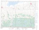
Maps showing Oskar Meadow, 1-1-22-W, Manitoba
Oskar Meadow is a Low vegetation located in 1-1-22-W, Manitoba and has an elevation of 672 meters.
- Latitude: 49° 0' 15'' North (decimal: 49.0041999)
- Longitude: 100° 17' 23'' West (decimal: -100.2896999)
- Topography Feature Category: Low vegetation
- Geographical Feature: Meadow
- Canadian Province/Territory: Manitoba
- Elevation: 672 meters
- Location: 1-1-22-W
- Atlas of Canada Locator Map: Oskar Meadow
- GPS Coordinate Locator Map: Oskar Meadow Lat/Long