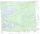
Maps showing Oskotim Creek, 20-70-3-E, Manitoba
Oskotim Creek is a River located in 20-70-3-E, Manitoba and has an elevation of 200 meters.
- Latitude: 55° 4' 37'' North (decimal: 55.0768999)
- Longitude: 97° 6' 22'' West (decimal: -97.1060999)
- Topography Feature Category: River
- Geographical Feature: Creek
- Canadian Province/Territory: Manitoba
- Elevation: 200 meters
- Location: 20-70-3-E
- Atlas of Canada Locator Map: Oskotim Creek
- GPS Coordinate Locator Map: Oskotim Creek Lat/Long
Oskotim Creek NTS Map Sheets