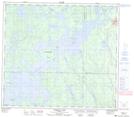
Maps showing Otaypwaywin Creek, 13-85-18-W, Manitoba
Otaypwaywin Creek is a River located in 13-85-18-W, Manitoba and has an elevation of 293 meters.
- Latitude: 56° 22' 10'' North (decimal: 56.3693999)
- Longitude: 100° 9' 18'' West (decimal: -100.1550000)
- Topography Feature Category: River
- Geographical Feature: Creek
- Canadian Province/Territory: Manitoba
- Elevation: 293 meters
- Location: 13-85-18-W
- Atlas of Canada Locator Map: Otaypwaywin Creek
- GPS Coordinate Locator Map: Otaypwaywin Creek Lat/Long
Otaypwaywin Creek NTS Map Sheets