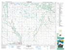
Maps showing Otter Creek, 36-17-18-W, Manitoba
Otter Creek is a River located in 36-17-18-W, Manitoba.
- Latitude: 50° 29' 38'' North (decimal: 50.4939000)
- Longitude: 99° 49' 57'' West (decimal: -99.8325000)
- Topography Feature Category: River
- Geographical Feature: Creek
- Canadian Province/Territory: Manitoba
- Location: 36-17-18-W
- Atlas of Canada Locator Map: Otter Creek
- GPS Coordinate Locator Map: Otter Creek Lat/Long
Otter Creek NTS Map Sheets