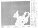
Maps showing Outer Sand Point, Manitoba
Outer Sand Point is a Cape located in Manitoba and has an elevation of 222 meters.
- Latitude: 52° 1' 0'' North (decimal: 52.0166999)
- Longitude: 97° 34' 11'' West (decimal: -97.5696999)
- Topography Feature Category: Cape
- Geographical Feature: Point
- Canadian Province/Territory: Manitoba
- Elevation: 222 meters
- Atlas of Canada Locator Map: Outer Sand Point
- GPS Coordinate Locator Map: Outer Sand Point Lat/Long
Outer Sand Point NTS Map Sheets