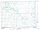
Maps showing Overstoneville, 32-1-5-E, Manitoba
Overstoneville is a Unincorporated area located in 32-1-5-E, Manitoba and has an elevation of 276 meters.
- Latitude: 49° 4' 30'' North (decimal: 49.0750000)
- Longitude: 96° 52' 54'' West (decimal: -96.8817000)
- Topography Feature Category: Unincorporated area
- Geographical Feature: Locality
- Canadian Province/Territory: Manitoba
- Elevation: 276 meters
- Location: 32-1-5-E
- Atlas of Canada Locator Map: Overstoneville
- GPS Coordinate Locator Map: Overstoneville Lat/Long