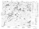
Maps showing Pakeetapeekanik Rapids, Manitoba
Pakeetapeekanik Rapids is a Rapids located in Manitoba and has an elevation of 242 meters.
- Latitude: 53° 56' 14'' North (decimal: 53.9372000)
- Longitude: 95° 4' 53'' West (decimal: -95.0814000)
- Topography Feature Category: Rapids
- Geographical Feature: Rapids
- Canadian Province/Territory: Manitoba
- Elevation: 242 meters
- Atlas of Canada Locator Map: Pakeetapeekanik Rapids
- GPS Coordinate Locator Map: Pakeetapeekanik Rapids Lat/Long
Pakeetapeekanik Rapids NTS Map Sheets