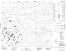
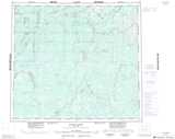
Maps showing Panco Lake, 87-4-E2, Manitoba
Panco Lake is a Lake located in 87-4-E2, Manitoba and has an elevation of 85 meters.
- Latitude: 56° 33' 47'' North (decimal: 56.5631000)
- Longitude: 93° 23' 59'' West (decimal: -93.3997000)
- Topography Feature Category: Lake
- Geographical Feature: Lake
- Canadian Province/Territory: Manitoba
- Elevation: 85 meters
- Location: 87-4-E2
- Atlas of Canada Locator Map: Panco Lake
- GPS Coordinate Locator Map: Panco Lake Lat/Long
Panco Lake NTS Map Sheets