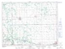
Maps showing Lac à Parker, 16-8-7-W, Manitoba
Lac à Parker is a Lake located in 16-8-7-W, Manitoba and has an elevation of 308 meters.
- Latitude: 49° 39' 27'' North (decimal: 49.6575000)
- Longitude: 98° 20' 59'' West (decimal: -98.3497000)
- Topography Feature Category: Lake
- Geographical Feature: Lac
- Canadian Province/Territory: Manitoba
- Elevation: 308 meters
- Location: 16-8-7-W
- Atlas of Canada Locator Map: Lac à Parker
- GPS Coordinate Locator Map: Lac à Parker Lat/Long