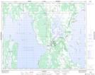
Maps showing Partridge Creek, 27-31-9-W, Manitoba
Partridge Creek is a River located in 27-31-9-W, Manitoba and has an elevation of 252 meters.
- Latitude: 51° 41' 43'' North (decimal: 51.6953000)
- Longitude: 98° 39' 50'' West (decimal: -98.6639000)
- Topography Feature Category: River
- Geographical Feature: Creek
- Canadian Province/Territory: Manitoba
- Elevation: 252 meters
- Location: 27-31-9-W
- Atlas of Canada Locator Map: Partridge Creek
- GPS Coordinate Locator Map: Partridge Creek Lat/Long
Partridge Creek NTS Map Sheets