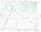
Maps showing Patterson Lake, 22-19-23-W, Manitoba
Patterson Lake is a Lake located in 22-19-23-W, Manitoba and has an elevation of 618 meters.
- Latitude: 50° 38' 52'' North (decimal: 50.6477999)
- Longitude: 100° 34' 57'' West (decimal: -100.5824999)
- Topography Feature Category: Lake
- Geographical Feature: Lake
- Canadian Province/Territory: Manitoba
- Elevation: 618 meters
- Location: 22-19-23-W
- Atlas of Canada Locator Map: Patterson Lake
- GPS Coordinate Locator Map: Patterson Lake Lat/Long
Patterson Lake NTS Map Sheets