Maps showing Pawn Creek, Manitoba
Pawn Creek is a River located in Manitoba and has an elevation of 247 meters.
- Latitude: 52° 19' 2'' North (decimal: 52.3172000)
- Longitude: 96° 26' 44'' West (decimal: -96.4456000)
- Topography Feature Category: River
- Geographical Feature: Creek
- Canadian Province/Territory: Manitoba
- Elevation: 247 meters
- Atlas of Canada Locator Map: Pawn Creek
- GPS Coordinate Locator Map: Pawn Creek Lat/Long
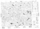
Pawn Creek NTS Map Sheets