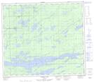
Maps showing Paynter Lake, 12,13-75-1-W, Manitoba
Paynter Lake is a Lake located in 12,13-75-1-W, Manitoba and has an elevation of 187 meters.
- Latitude: 55° 29' 16'' North (decimal: 55.4877999)
- Longitude: 97° 28' 14'' West (decimal: -97.4705999)
- Topography Feature Category: Lake
- Geographical Feature: Lake
- Canadian Province/Territory: Manitoba
- Elevation: 187 meters
- Location: 12,13-75-1-W
- Atlas of Canada Locator Map: Paynter Lake
- GPS Coordinate Locator Map: Paynter Lake Lat/Long
Paynter Lake NTS Map Sheets