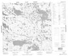
Maps showing Peden Island, Manitoba
Peden Island is a Island located in Manitoba and has an elevation of 242 meters.
- Latitude: 59° 12' 29'' North (decimal: 59.2080999)
- Longitude: 97° 38' 22'' West (decimal: -97.6393999)
- Topography Feature Category: Island
- Geographical Feature: Island
- Canadian Province/Territory: Manitoba
- Elevation: 242 meters
- Atlas of Canada Locator Map: Peden Island
- GPS Coordinate Locator Map: Peden Island Lat/Long
Peden Island NTS Map Sheets