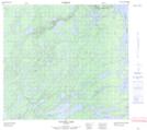
Maps showing Peecheeponakin Lake, Manitoba
Peecheeponakin Lake is a Lake located in Manitoba.
- Latitude: 57° 17' 9'' North (decimal: 57.2857999)
- Longitude: 98° 51' 27'' West (decimal: -98.8574999)
- Topography Feature Category: Lake
- Geographical Feature: Lake
- Canadian Province/Territory: Manitoba
- Atlas of Canada Locator Map: Peecheeponakin Lake
- GPS Coordinate Locator Map: Peecheeponakin Lake Lat/Long
Peecheeponakin Lake NTS Map Sheets