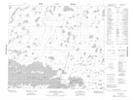
Maps showing Peetamanitou Lake, Manitoba
Peetamanitou Lake is a Lake located in Manitoba.
- Latitude: 54° 46' 27'' North (decimal: 54.7741999)
- Longitude: 93° 38' 45'' West (decimal: -93.6457999)
- Topography Feature Category: Lake
- Geographical Feature: Lake
- Canadian Province/Territory: Manitoba
- GPS Coordinate Locator Map: Peetamanitou Lake Lat/Long
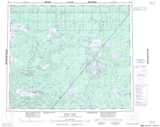
Peetamanitou Lake NTS Map Sheets