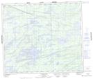
Maps showing Pemechikamik Portage, 69,70-6-E, Manitoba
Pemechikamik Portage is a Road feature located in 69,70-6-E, Manitoba and has an elevation of 213 meters.
- Latitude: 55° 1' 30'' North (decimal: 55.0249999)
- Longitude: 96° 35' 12'' West (decimal: -96.5866999)
- Topography Feature Category: Road feature
- Geographical Feature: Portage
- Canadian Province/Territory: Manitoba
- Elevation: 213 meters
- Location: 69,70-6-E
- Atlas of Canada Locator Map: Pemechikamik Portage
- GPS Coordinate Locator Map: Pemechikamik Portage Lat/Long
Pemechikamik Portage NTS Map Sheets