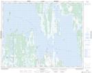
Maps showing Pentamerus Point, 30-13-W, Manitoba
Pentamerus Point is a Cape located in 30-13-W, Manitoba and has an elevation of 256 meters.
- Latitude: 51° 34' 51'' North (decimal: 51.5807999)
- Longitude: 99° 16' 27'' West (decimal: -99.2742000)
- Topography Feature Category: Cape
- Geographical Feature: Point
- Canadian Province/Territory: Manitoba
- Elevation: 256 meters
- Location: 30-13-W
- Atlas of Canada Locator Map: Pentamerus Point
- GPS Coordinate Locator Map: Pentamerus Point Lat/Long
Pentamerus Point NTS Map Sheets