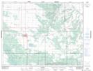
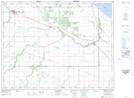
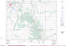
Maps showing Pine Creek, 1-14-10-W, Manitoba
Pine Creek is a River located in 1-14-10-W, Manitoba and has an elevation of 333 meters.
- Latitude: 50° 9' 32'' North (decimal: 50.1589000)
- Longitude: 98° 43' 6'' West (decimal: -98.7182999)
- Topography Feature Category: River
- Geographical Feature: Creek
- Canadian Province/Territory: Manitoba
- Elevation: 333 meters
- Location: 1-14-10-W
- Atlas of Canada Locator Map: Pine Creek
- GPS Coordinate Locator Map: Pine Creek Lat/Long
Pine Creek NTS Map Sheets