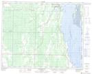
Maps showing Pine Creek Settlement, 35-20-W, Manitoba
Pine Creek Settlement is a Geographical area located in 35-20-W, Manitoba.
- Latitude: 51° 59' 17'' North (decimal: 51.9881000)
- Longitude: 100° 9' 9'' West (decimal: -100.1524999)
- Topography Feature Category: Geographical area
- Geographical Feature: Settlement
- Canadian Province/Territory: Manitoba
- Location: 35-20-W
- Atlas of Canada Locator Map: Pine Creek Settlement
- GPS Coordinate Locator Map: Pine Creek Settlement Lat/Long
Pine Creek Settlement NTS Map Sheets