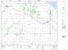
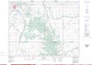
Maps showing Pine Creek Station, 23-12-12-W, Manitoba
Pine Creek Station is a Unincorporated area located in 23-12-12-W, Manitoba and has an elevation of 298 meters.
- Latitude: 50° 1' 52'' North (decimal: 50.0311000)
- Longitude: 99° 0' 2'' West (decimal: -99.0005999)
- Topography Feature Category: Unincorporated area
- Geographical Feature: Locality
- Canadian Province/Territory: Manitoba
- Elevation: 298 meters
- Location: 23-12-12-W
- Atlas of Canada Locator Map: Pine Creek Station
- GPS Coordinate Locator Map: Pine Creek Station Lat/Long
Pine Creek Station NTS Map Sheets