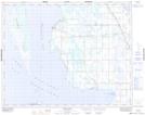
Maps showing Pikes Point, 26-28-11-W, Manitoba
Pikes Point is a Cape located in 26-28-11-W, Manitoba and has an elevation of 254 meters.
- Latitude: 51° 25' 29'' North (decimal: 51.4247000)
- Longitude: 98° 53' 40'' West (decimal: -98.8944000)
- Topography Feature Category: Cape
- Geographical Feature: Point
- Canadian Province/Territory: Manitoba
- Elevation: 254 meters
- Location: 26-28-11-W
- Atlas of Canada Locator Map: Pikes Point
- GPS Coordinate Locator Map: Pikes Point Lat/Long
Pikes Point NTS Map Sheets