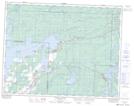
Maps showing Pinawa Bay, 6,7-16-13-E, Manitoba
Pinawa Bay is a Unincorporated area located in 6,7-16-13-E, Manitoba and has an elevation of 268 meters.
- Latitude: 50° 19' 27'' North (decimal: 50.3242000)
- Longitude: 95° 47' 31'' West (decimal: -95.7918999)
- Topography Feature Category: Unincorporated area
- Geographical Feature: Community
- Canadian Province/Territory: Manitoba
- Elevation: 268 meters
- Location: 6,7-16-13-E
- Atlas of Canada Locator Map: Pinawa Bay
- GPS Coordinate Locator Map: Pinawa Bay Lat/Long
Pinawa Bay NTS Map Sheets